
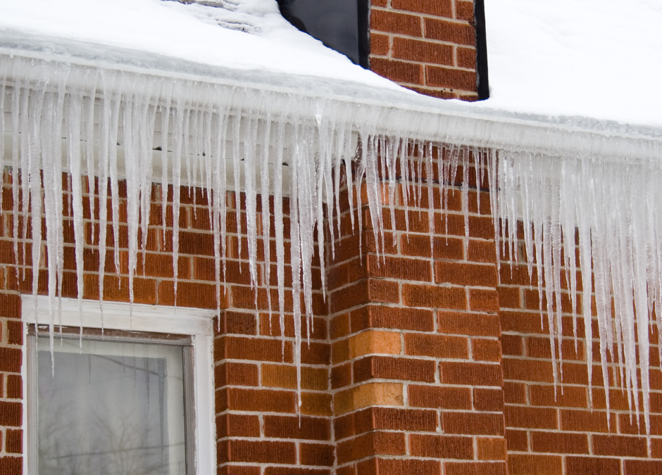
A frosty roofline can appear suddenly after a mild fall afternoon. In Nashville and Knoxville, one section of a gutter may turn white before sunrise while another looks unchanged. As the morning warms, most of the coating may vanish, yet a shaded corner or outlet can remain icy.
These differences do not automatically indicate a gutter problem. Frost reflects a combination of surface temperature, moisture, wind, shade, and the previous day’s weather. Its pattern can nevertheless help homeowners make better observations before winter conditions become more frequent.
Why Metal Gutters Collect Frost
On clear, calm nights, exposed surfaces release heat. A metal gutter can become cold enough for water vapor in the air to form ice crystals on the exterior. This may happen even when the reported air temperature is slightly above freezing because surface temperature and air temperature are not always identical.
When cars, grass, roofs, and gutters all have a light, feathery coating, the moisture is likely part of the same weather event. Frost on the outside of the gutter does not, by itself, mean water escaped from the inside.
The coating may clear at different rates. Direct morning sun warms one elevation sooner than another. Roof overhangs, tree cover, nearby hills, and surrounding buildings can keep certain sections shaded, especially in East Tennessee terrain.
Surface Frost Is Not the Same as Ice in the Channel
Ordinary frost is usually thin and broadly distributed. Ice formed from standing water tends to be thicker and confined to a low spot, outlet, seam, or area where debris has accumulated. It exists because liquid water remained long enough to freeze.
Recent rain is only one possible source. Damp leaves may release moisture, roof frost can melt and refreeze, or water can drain slowly through a restricted section. A single view from the ground cannot determine which explanation applies.
The most useful comparison happens after temperatures rise. A normal surface coating often fades with surrounding frost. A solid piece of ice may melt more slowly, leaving a wet patch or brief trickle at one location.
How Leaves and Organic Material Affect Freezing
Late October often leaves Tennessee gutters holding a mixture of broad leaves, pine needles, small twigs, and decomposed material. Even when the top looks dry, material underneath may remain damp. That moisture can bind the debris together when temperatures fall.
A frozen debris mass can temporarily narrow the route toward a downspout. During a daytime thaw or the next rain, water may move around the material differently than it did before freezing. This can create overflow in one storm but not another.
Gutter and downspout cleaning concerns debris within that route. It does not stop normal frost from forming on an exposed metal surface, and frost alone is not evidence that cleaning is needed.
Freeze-Thaw Patterns Around Outlets and Edges
Nashville and Knoxville can experience cool nights followed by milder afternoons. When ice melts during the day and freezes again overnight, the new ice may appear somewhere other than the original frosted area.
An icicle below the front edge may follow earlier overflow, but wind-driven rain or melting roof frost can produce a similar appearance. Ice behind the gutter suggests water followed the roof edge or rear side rather than crossing the front lip. A thicker patch near an outlet may indicate that water was slow to leave that point.
These are clues, not final conclusions. Roof geometry, valleys, slope, shade, debris, and the amount of water entering the gutter all influence the pattern.
Compare Nashville and Knoxville Conditions Carefully
The two markets do not always experience the same overnight conditions. Elevation, terrain, cloud cover, and local temperature can give a Knoxville-area home frost while a Nashville property remains clear, or the reverse. Conditions may also vary within the same neighborhood.
For that reason, a distant weather reading is less useful than what is visible at the home. Note whether frost appears across the yard and roof, whether only one gutter section is affected, and how long the coating remains after sunrise.
A Safer Way to Observe Cold-Weather Moisture
Stay on the ground. Frost can make roofs, ladders, walkways, and decks slippery, and thawing ice can fall without warning. A zoomed photograph from a clear location can capture the roofline without climbing.
Take one image early and another after the sun or warmer air reaches the house. Record whether there was rain the previous day and whether the icy patch returns after future storms. During rainfall, watch from shelter for water going over the front, behind the gutter, or toward the nearest downspout.
Understanding the First Frost
A uniform layer that disappears with the morning warm-up is consistent with ordinary frost. Ice that repeatedly forms at a wet low point, debris pocket, or overflow location provides a different type of evidence. Neither pattern should be interpreted from appearance alone.
For Nashville and Knoxville homeowners, timing and repetition are the clearest guides. Observations across several mornings and rain events can separate a brief seasonal coating from moisture that regularly remains in one part of the gutter system.